Last weekend’s news of the La Cruz (Costa Rica) Coastal Tourism Corridor just south of the Nicaragua border has evoked stories of the “South Coastal Highway of Nicaragua” (aka The Coastal Road or Tourist Route) as some of the players in the Nicaraguan tourism industry began lamenting about how the project would have been (and still could be) the perfect complement to the La Cruz project.
Comments in the press since the weekend also revisit the idea of a new border post between both countries at El Naranjo (Nica side) and Conventillos (CR side) as being a good start. It has always been a good suggestion to create a border crossing for tourist traffic, leaving the Peñas Blancas location for trucks and buses on the commercial Pan Am route.
Lucy Valenti, the President of CANATUR, the National Chamber of Tourism of Nicaragua commented that with Liberia being so close to the border with Nicaragua and a new crossing, it would really open up the possibility of promoting the multi-destination packages that the La Cruz initiative is talking about. In addition, Valenti said that the construction of the coastal highway would help to stimulate and promote the development of tourism.
South Coast Highway – A Brief History
The Project: To build a 141 kilometer (88 mile) tourist route from Costa Rica (with a new border crossing at El Naranjo south of Ostional) that would follow the coast line all the way north to Masachapa and span the departments of Rivas, Carazo and Managua.
This project was conceived in 2004 under Enrique José Bolaños Geyer, an engineer and the President of Nicaragua from January 10th, 2002 to January 10th, 2007.
Since 2004, it is estimated that millions of dollars has been spent on various designs as the original plan for a South Coast Highway (Carretera Litoral Sur) changed over the years to more of a tourist route known as La Costanera (a road that runs along the coast or a river).
The last information published on the funding of the ongoing plan was in February 2018 when the Central American Bank for Economic Integration (BCIE by its acronym in Spanish) signed some loan agreements for US $ 238 million for road improvements and rehabilitation in Managua, Masaya, León, Estelí, Jinotega and the two Caribbean regions.
Even though there was no mention of the Coastal Road in that group of projects, at the same that that the BCIE announced those loans, they also announced that they had allocated US $1.4 million to “pre-investment and design studies” of Phase I of the Carretera Litoral Sur o La Costanera from the community of El Naranjo (Costa Rica Border) to Masachapa (on the coast in the Department of Managua).
Since the failure of Enrique Bolaños government to get the project even started during his term, it’s been resuscitated on a couple of occasions over the last 15 years yet each time a lack of funding prevents it from going ahead.
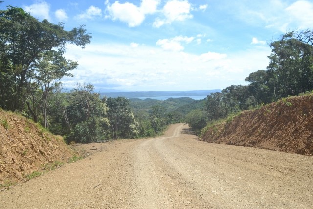
The closest to an actual start was in 2017 when there was a huge improvement of a section of road from the border with CR to just south of Ostional which did include the construction of two vehicular bridges at El Naranjo and El Pochote.
Originally, the 141 kilometers of the South Coastal Highway Nicaragua were going to be built from north to south. Section 1 was from Masachapa to Las Salinas (67 km long), Section 2 from Las Salinas to San Juan del Sur (38 km long) and Section 3 from San Juan del Sur to the border with Costa Rica (36 km long).
The latest plan in 2017 had it starting at the border and finishing in Masachapa.


